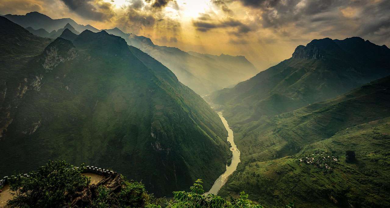
The Most Beautiful & Famous Rivers In Vietnam
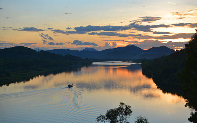
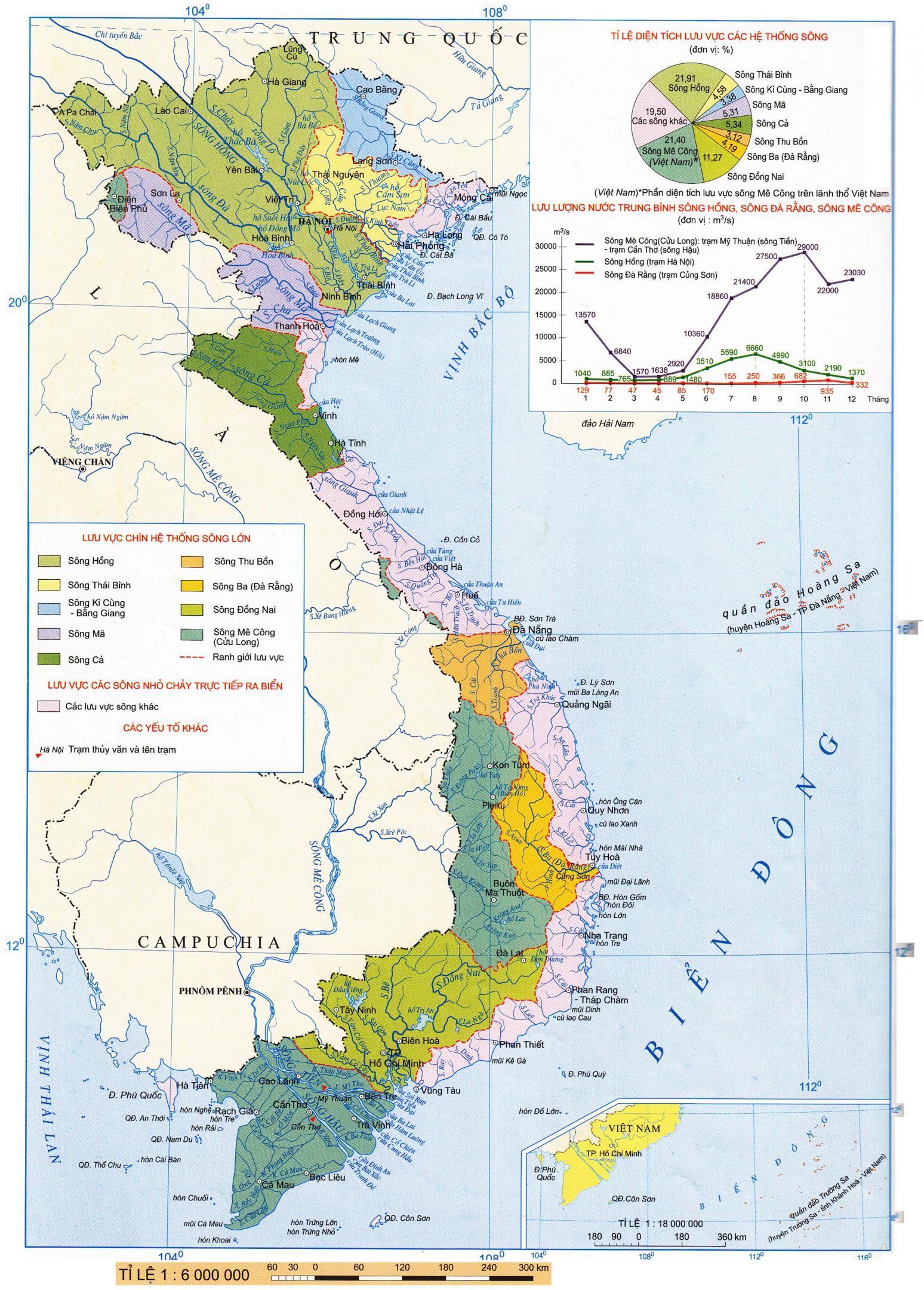
With a dense network of 2,360 rivers scattered from North to South and the total length at 41,900 km, Vietnam’s culture and traditions have long been strongly connected to those constant flows. Among them, many rivers have built up over the years together with the ups and downs of Vietnamese history. Vietnam’s rivers have been considered as an indispensable part of the wet rice civilization, main topic imprinting in the proverb folk songs, local daily life activities and travel aspects. Below is Top 10 Most Beautiful & Famous Rivers in Vietnam that tourists should visit, recommended by Vietnam Travel.
Table of Contents
1. Nho Que River (Sông Nho Quế)
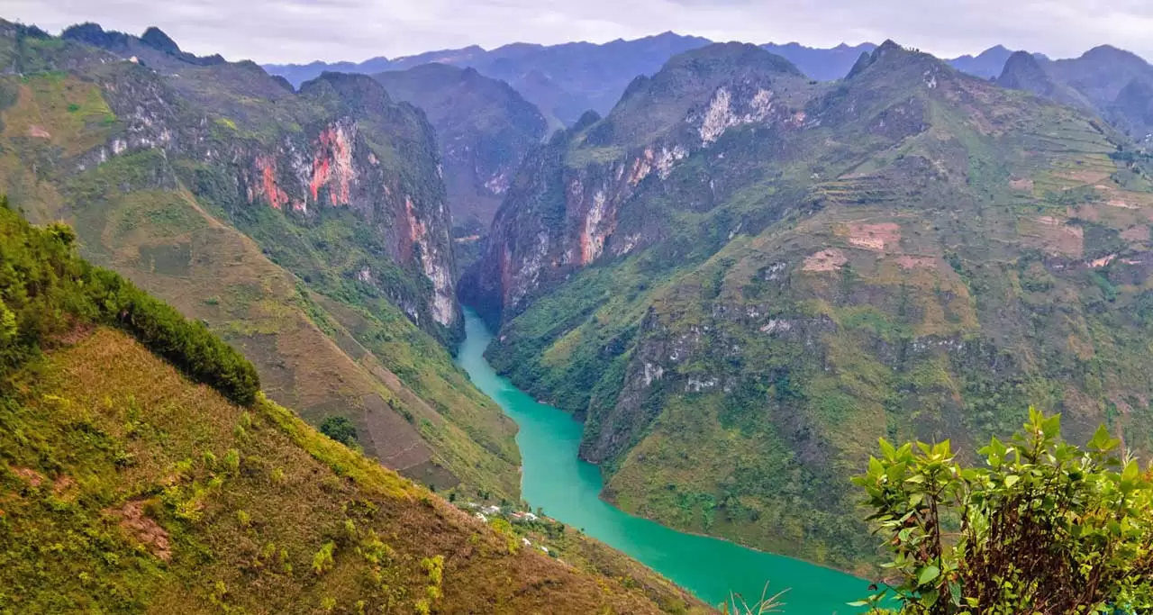
Nho Que River (Ha Giang), one of the most beautiful rivers in Vietnam.
Nho Que River starts its flow from Nghiem Son Mountain, China at the height of 1,500m. The upper area consists of more than 5 kilometers in the border between Vietnam and China, creates waterfall in the middle of the valley due to its quite slope, strong flow through rugged rock. When entering Vietnam’s territory, Nho Que River proceeds through the Tu San Canyon and continues its journey along the Ma Pi Leng Pass then it reaches Meo Vac District, about 15 km far from Lung Cu Town. Two river branches are formed when the river is in Cao Bang then entering the Gam River at the Na Mat falls.

Conquering the legendary Ma Pi Leng Pass and stopping by the Ma Pi Leng viewpoint to look down to Nho Que River is the dream of many adventurous motorbike-riding lovers. From above, the river looks like a silky fillet with a beautiful turquoise blue color, looming in fog which brings tourists a pleasant feeling of a naturally romantic masterpiece and makes them do not want to leave.
To immerse yourself in the immense landscape of spectacular Nho Que River, tourists are highly recommended to take the ride along the river’s bank to witness the indigenous villages via the trails etched out by the locals that live here. The route cuts through jagged cliffs, around river pools, and along the deep ravine here.
Nho Que River is regarded as the legendary of poetry and a beautiful symbol of Ha Giang travel.
2. Red River (Sông Hồng)
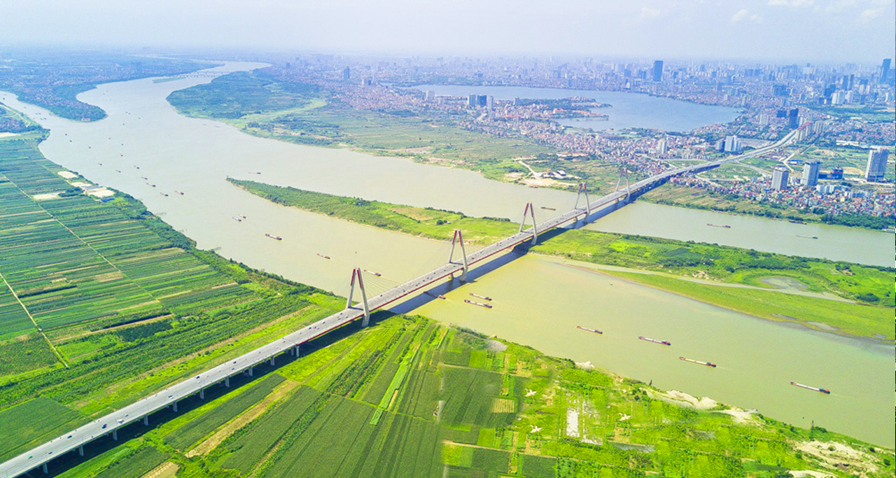
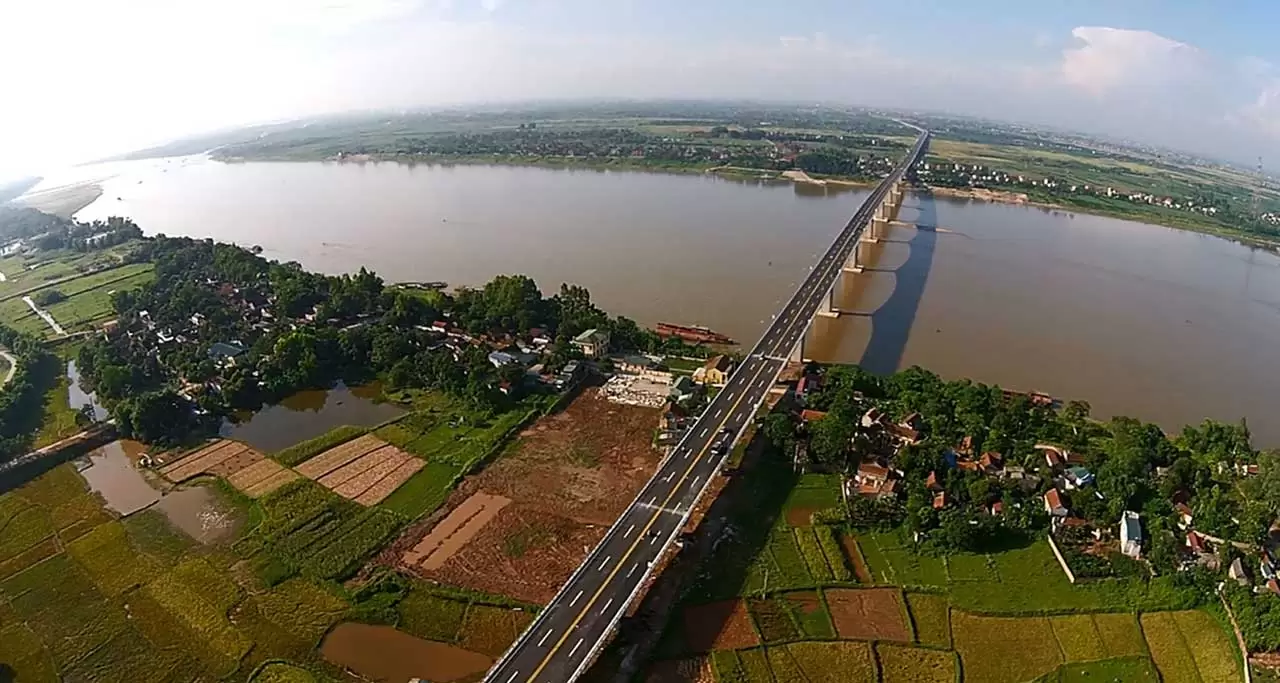
Red River and Nhat Tan Bridge that connects Noi Bai International Airport & Hanoi City.
Red River – one of the two longest rivers in Northern Vietnam, plays an important role for the daily life of local people living in the northern area. The river begins in Yunnan province (China) and flows southeastward through deep, narrow gorges to enter Vietnam at Lao Cai, then cuts southeast through nine provinces and eventually discharge into the Gulf of Tonkin via a great delta. The name of Red River was resulted from its silt-laden water with high volume of iron oxide, making its water become red color all year round.
The River flows through Hanoi Capital and carries its nutrient-rich water to the delta where local inhabitants have been practicing wet rice cultivation for centuries. The nutrients that flow along with the Red River bring vibrant shades of earthy green and red to the both shores. Because together with rice – the principal crop of the delta; wheat, beans, rapeseed, corn, and subtropical crops are also grown by local farmers. The area experiences yearly flooding so locals built up and elaborate network of dikes and canals to protect the land and people from the floodwaters.
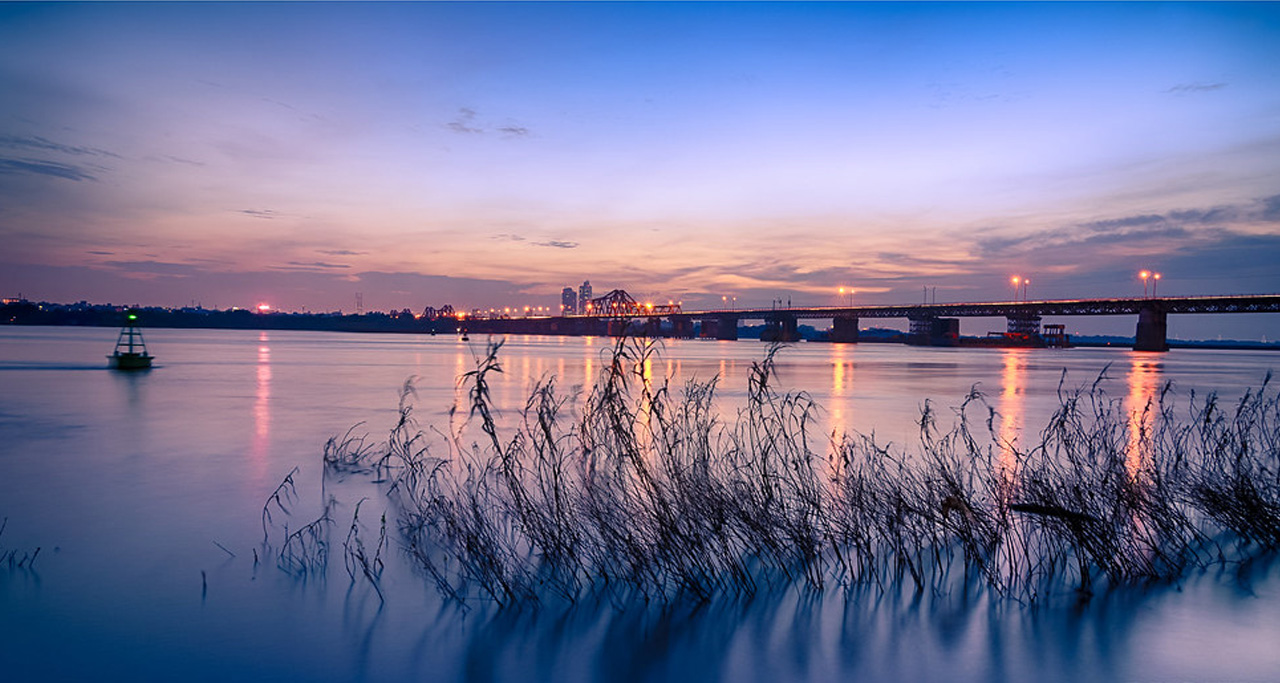
Tranquil Hanoi’s Red River and Long Bien Bridge at sunset.
In Southeast Asian monsoon plains like Red River Delta, replanting work, a technique necessary for attaining very high rice yields and obtaining two harvests every year, has seasonally required a large workforce. During the off-season, farmers left the land fallow thus encouraging them to pursue other non-agricultural activities to earn their livings. That’s the origin of craft villages organized into clusters in the delta. Villages specialized in a wide variety of crafts that ranged from the making of conical hats to the production of ceramic and pottery. The tradition continues to the present day in the form of Red River Delta’s famous craft villages, mostly clustered in the rural areas surrounding Hanoi and now become major tourist attractions.
First comers visiting Hanoi can be introduced about several bridges over the Red River. But the two most significant ones are Nhat Tan and Long Bien Bridge. With the length of 5km, Nhat Tan is the highest suspension bridge in Vietnam, linking the Noi Bai International Airport and the Hanoi city centre. It was inaugurated in 2015 and now becomes a new icon of the modern capital city, its five towers symbolizing the five ancient gates of Hanoi.
The city tour of Hanoi will not be completed without the visit to the historic Long Bien Bridge which was built by the French company Daydé & Pille between 1898 and 1902. It is not only a symbol of Hanoi but an outdoor museum of the capital city’s history. Despite of the appearances of newer and more modern bridges over the Red River, the two-century old Long Bien Bridge is still a favorite spot for Hanoians, allowing them to contemplate the Red River in peace and admire the architectural jewel in this history crown.
3. Ngo Dong River (Sông Ngô Đồng)
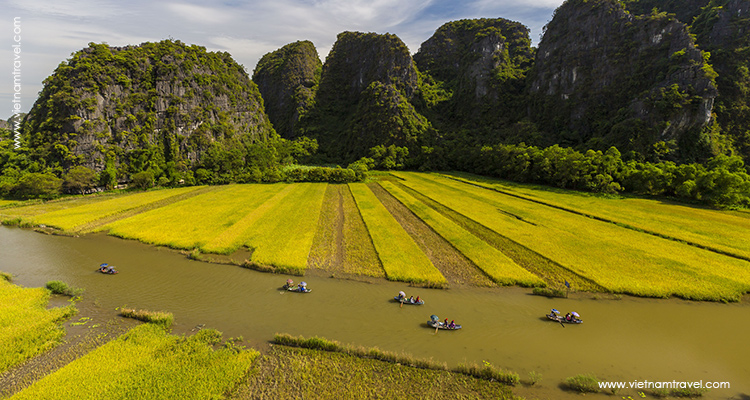
Every year, the famous Ngo Dong River receives thousands of tourists to visit Tam Coc (Ninh Binh) on sampans.
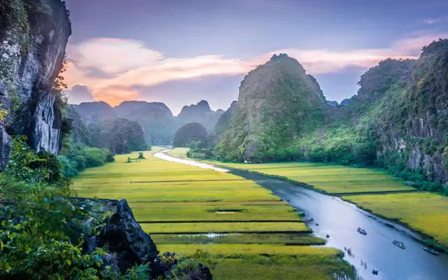
When thinking about a day trip to Ninh Binh from Hanoi, the first thing comes in every tourist’s mind must be the two hour rowing boat ride in Tam Coc along Ngo Dong River. Ngo Dong River is a small one in Ninh Hai Commune, Hoa Lu District, Ninh Binh – an attractive tourist destination in the North Vietnam. The river flows from the low area in the heart of limestone mountains of Trang An Landscape Complex World Heritage, creeps through mountains cliffs and rice fields. Ngo Dong River – the name itself brings a very romantic sentiment and makes us curious to find out its meaning. The end of May and the early of June is the time of rice harvesting season. At this time, the rice fields spreading along the river’s banks turn into yellow, dye the river into the golden color as the color of maize. Therefore, the name Ngo Dong (translated as Corn Field) was used to call this poetic river. In the sunny days, the river reflects the sunshine that make the scene become more sparkling than ever. To behold this river in its ultimate charming beauty, just challenge yourself by overcoming 486 stone steps to the peak of nearby Mua Cave. From this viewpoint, you can have a most realistic and vivid panoramic view of rowing boats running leisurely along the river, the two riversides with fragrant ripen yellow rice fields and surrounded by majestic limestone mountains. This wonderful picture will surely captivate your heart and become an unforgettable impression on your travels.
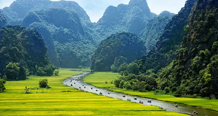
Ngo Dong River goes through rice fields and limestone karsts, making Tam Coc’s dramatic landscape scenery.
Ngo Dong River is the ultimate way heading to Tam Coc – the legendary “Halong Bay on land”. A simple, traditional paddle-boat trip will let the tourists truly realize the serenity and beauty of nature along the way. The boat passes through the limestone mountains, through 3 caves including Ca Cave, Hai Cave, and Ba Cave, making visitors feel like they are on the journey in another Ha Long Bay. The two hour boat ride along Ngo Dong River is an interesting journey in itself as the oarsmen and women do not simply row the boats as a job but also tell stories of local life along the river, making one’s trip a truly enchanting memory to keep sacred forever.
4. Ben Hai River (Sông Bến Hải)
Despite of not being one of the most famous rivers in Vietnam, Ben Hai River in Central Vietnam is best known for its historic meaning as the boundary that separated two parts of Vietnam during the Vietnamese – American War: the North was controlled by the Democratic Republic of Vietnam and the South was under the management of the Republic of South Vietnam. At the Geneva Conference in July 1954, agreements were made that the French would withdraw their troops from northern Vietnam and the country would be divided in two until elections, at which time a president would be decided and the country reunited. The boundary was the Ben Hai River, which runs along the 17th parallel, with a five kilometer buffer extended on either side becoming the demilitarized zone (DMZ). In that instant, families and loved ones were physically divided. It was an important step towards a bloody war that would tear the country apart. (The elections never happened.) The division last for 21 years along with the great struggle of Vietnamese for national reunification.
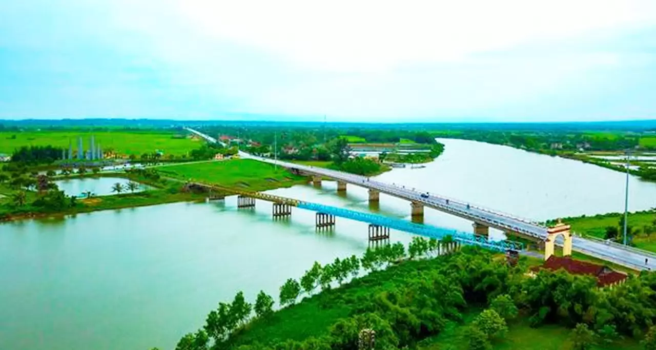
The historic Ben Hai River, which divided the North & South of Vietnam under the American war.
Ben Hai River originates from Dong Chan mountain in Truong Son mountain range, flows along the 17°North parallel from west to east and flows into the sea at Cua Tung (Tung River Mouth).
Together with Ben Hai River, Hien Luong Bridge is an indispensable image and once stood as a symbol of the country’s longing for unification. The bridge is located in Vinh Linh District, Quang Tri Province, was built with simple woods to serve pedestrians by the French colonialists in 1952. But it was destroyed by the American bombs during the Vietnam War in 1967. It was restored and given a new look when it opened again on May 18, 2003.
Hien Luong Bridge and the Ben Hai River had to suffer so much pain and loss during the war against American, enduringly waiting for the independence and great victory in the spring of 1975, when the country officially resumed the Hien Luong – Ben Hai banks. Relic sites located on both banks of the river have been recognized as special national historical relics.
5. Son River (Sông Son)
Every tourists may be very familiar with the boat ride taking them to explore Phong Nha Cave – the top highlighted attraction in Quang Binh Province. And that boat trip is taken along the gentle Son River – a great place to experience how a river transforms from above ground to below.
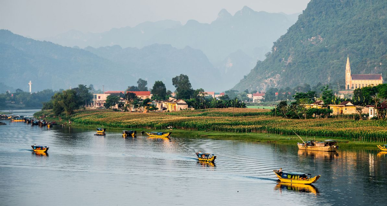
Son River in Quang Binh Province, home to World’s largest cave: Son Doong.
With the length of 35 km, Son River is a tributary of the Gianh River in North Central Vietnam, entirely flowing in the territory of Bo Trach District, Quang Binh Province. The river takes its journey from the mouth of the Phong Nha cave with a upstream part of the 7,729m long river that flows underground in the limestone mountain range in west of Quang Binh and in the heart of the Phong Nha – Ke Bang Heritage Forest as well. Not only is it famous as the entrance to the well-known Phong Nha Cave, the river is also known by its own charming beauty. The green colored waters of Son River are the perfect reflection of the Ke Bang limestone mountains it passes through.
There were many legends associated with the river’s name but the most popular is the love story of a dearly loving couple. They were separated by their families due to their different social status. Finally, the couple came to the river and suicide because they wanted to be with each other forever. The villagers were touched by their love, so they named the river as Son River – the symbol of faithful heart of lovers.
6. Perfume River (Sông Hương)
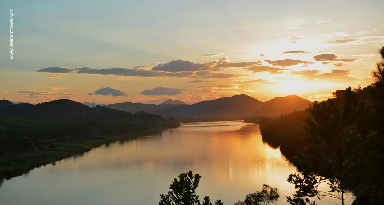
Perfume River (Hue) is the most romantic and gentle in the Central Vietnam.
Situated in Hue Imperial City, Perfume River is one of the most famous rivers in Central Vietnam. The river spans approximately 80km in length, flowing from Truong Son Mountain through Hue City Centre and Bang Lang Fork, running through many rustic villages in Hue like Kim Long, Nguyet Bieu, Vy Da, Dong Ba, Gia Hoi, Cho Dinh, Nam Pho, and Bao Vinh. The river had its name over 100 years ago, from the scent of flowers that bloom along the river’s banks in the autumn and drop in the water from upriver orchards, giving a strong fragrant aroma to the river.
In terms of Hue’s architecture in the past, Perfume River was considered as the natural trench to protect the ancient capital from the King Kim Long (1630 – 1687) to King Phu Xuan (1687 – 1712). Morever, the river strongly associates with Hue local cultural life. All forms of traditional culture such as Ca Hue (Hue traditional folk song), rowing boat racing are still intact until now. The river is also the main inspiration for many artists to compose famous poems, songs and pictures. Together with Ngu Binh Mountain, Perfume River is the symbol of Hue’s endless beauty and culture.
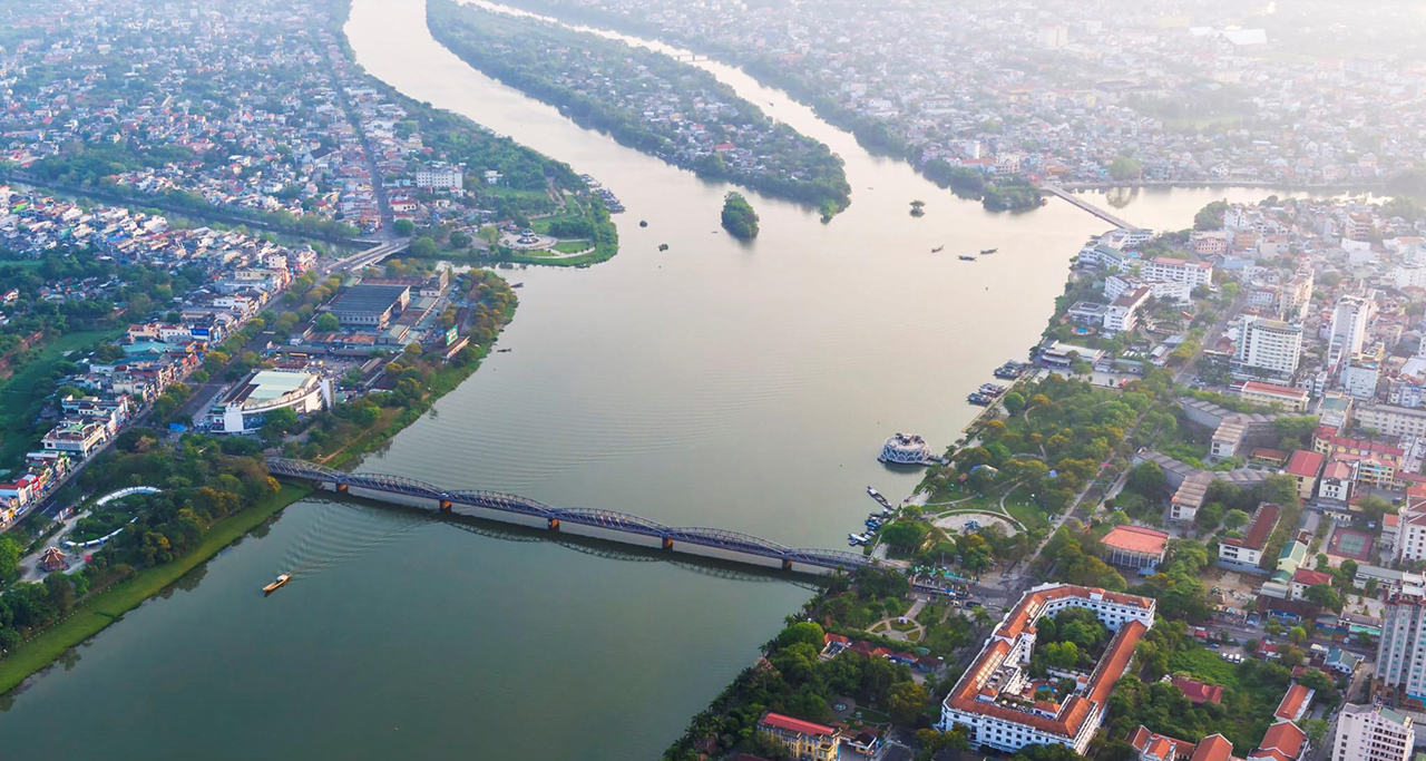
Truong Tien Bridge spans over Perfume River, connecting Hue Citadel & the city.
While you are in Hue City, it will be a miss if not taking a dragon boat trip along the Perfume River, a fantastic way to soak up some of the air of Hue City and watching the slow bustle of river life. A significant quantity of inhabitants are still living in ships on the Perfume River and the waterways of Hue like Dong Ba and Hen islet. The boat trip takes tourists to Hue’s iconic landmarks such as Thien Mu Pagoda, Hon Chen Temple and some king tombs. Typically they are Tu Duc and Minh Mang Tombs. The waterfront gets very lively in the evening. Local youths often gather as small groups at the river front park to enjoy breathtaking sunset views of Perfume River. The Trang Tien Bridge (Cau Truong Tien) also becomes illuminated with colorful LED lights, resulting in an impressive sight.
One highlight in this tranquil city’s nightlife is reserving a seat on Perfume River dinner cruise. During this river journey, passengers will admire the purple sunset, listen to the Hue traditional folk song performed by local artists and enjoy local specialities. Visitors will also have a chance to put the paper lotus lanterns down the Perfume River and make a wish before saying farewell the cruise team.
7. Han River (Sông Hàn)
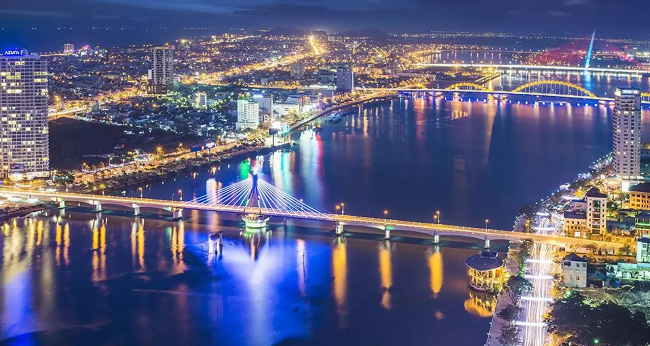
Danang is regarded as “The City of Bridges” with many bridges crossing Han River, which facilitate the city’s travel, trade and economic development. Han River is the major river flowing through the hear of Danang City. However, the river is most famous for the incredible bridges and surrounding activities rather than the water itself. The waters begin from the merge of three districts: Cam Le, Hai Chau and Ngu Hanh Son and then flow roughly 7km before the river flows through Danang Bay.
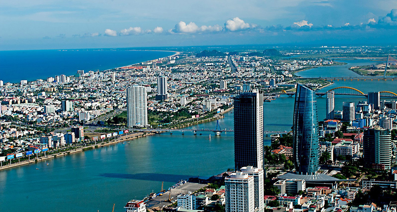
Panoramic view of Han River, Danang City and the East Sea.
Han River is a magnet for impressive structures and sights to see. The river’s edge is the chosen spot to host an annually international fireworks competition attracting millions of tourists from all around the world. Additionally, there are nine bridges that cross the Han River around Da Nang that vary from fire-breathing Dragon Bridge (Cau Rong) to incredible Rotating Han River Bridge (Cau Quay). Don’t miss the chance to check out the Dragon Bridge on weekends. This impressive structure comes to life in a fury of flames and water on Saturday and Sunday evenings. There are many options for you to witness the splendid beauty of the Han River’s bridges. Taking a cruise along the river is the number one choice if you want to have a unique view. Other than that, high-rise buildings are also perfect places. Choose yourself a place like a hotel, a plaza, or a high building located along the river’s banks which offers a stunning view. Besides those multistory buildings, you can choose some public areas like the public square, park or any nearby nice cafe to enjoy the sight.
8. Hoai River (Sông Hoài)
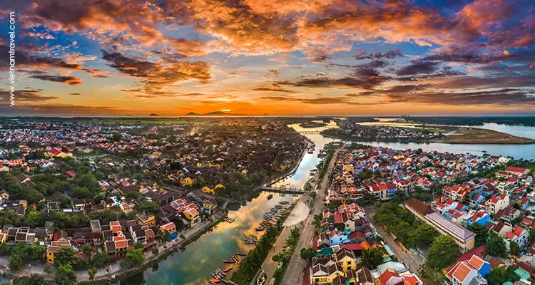
Hoai River in Hoi An Ancient Town, Quang Nam Province.
The ancient town of Hoian is situated in Hoai River – a tributary of the Thu Bon River, about 30 km from Danang City. The small river running through the town brings cool water and also sets up a stunning and poetic landscape. The river seems to be an indispensable symbol of the ancient town in the mindset of locals and tourists. It is associated with the daily life of local residents who row boats to carry tourists everyday. Being on a 30 minute boat along Hoai River is really an exciting experience to witness the beauty of Hoian Ancient Town from a different viewpoint, and listening the boatman to tell the interesting stories about their daily lives, town’s culture and history over years.
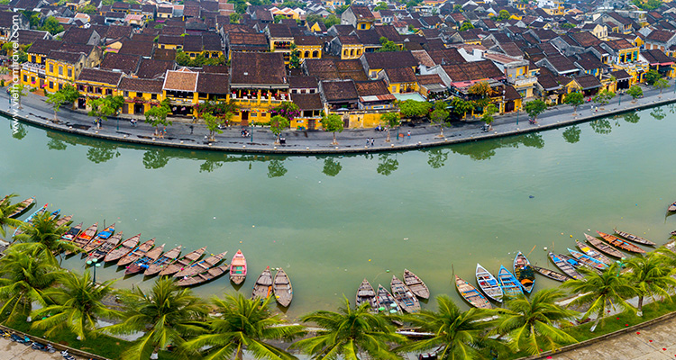
A tourist boat pier on Hoai River, Hoian Ancient City.
Not be equipped with machine, boats here are rowing boats so tourists can listen to the sound of paddles rowing in the water in the peaceful ambiance, and will deeply fall in love with this lovely charming town. When night comes, the river becomes a sparkling fairy tale in the light of colorful lanterns hanging over the nearby streets and on the boats. On a wooden boat floating slowly on the river in gentle breeze, tourists can immerse themselves into the traditional folk songs performed by local girls singing the chants of the Quang area (traditional folk songs). The rustic singing gently spreads over the river, making the visitors relaxed.
If you are lucky enough to be in Hoian on the night of the 14th of every lunar month, you can see that all people in the town turn off all electric lights and hang decorative colored lanterns in front of their houses. This is a practice that has existed for over 300 years. In the quietness of the night, the town looks more beautiful in the moonlight. The incense fragrance from a tray of offerings placed under the front eave makes the atmosphere more shimmering and splendid.
9. Serepok River (Sông Sêrêpôk)
Located in the west of Truong Son mountain ranges, Serepok River is 406km long and is the largest river in the river system of Dak Lak Province. Taking its name from the Khmer title “Tonle Xrepok”, the Serepok or Srepok River is an important tributary of the Mekong River that originates from Cambodia before flowing into Vietnam.
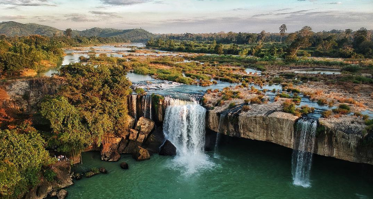
Serepok River, Dak Lak Province (in the Central Highlands Vietnam).
There was a heart-breaking love story to explain the confluence of the Krong Knoo and Krong Ana streams to the mouth of the river. Once upon a time, a man from Kuop village and a girl on the other side of the Serepok river fell in love with each other. However, two families have had strong conflicts against each other for hundred years so did not accept the descendants to love each other then find many ways to divide the young love couple. One day, the loving couple was detected but tried to fight for their love. On a coll moon night in the Serepok River, they hold hands and jumped into the river to suicide together. After their death, the black cloud suddenly came and made the sky black, and the river flowing rushing water. On the following day, the river turned into two branches which are called now Krong Knoo and Krong Ana (names of the couples). When these gentle streams combine, the mixing waters turn to aggressive churning rapids as though battling each other for dominance of the riverbed that hosts them. That is an interesting transformation as the symbol of eternal strong love.
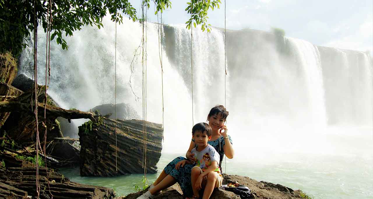
Serepok River creates many beautiful waterfalls in the Central Highlands, and Dray Nur is one of them.
Serepok River is also well known as the paradise of many impressive waterfalls like Trinh Nu Waterfall, Dray Sap Waterfall, Dray Nur Waterfall, Gia Long Waterfall, and Bay Nhanh Waterfall, which are interesting spots for those who love exploring the wild nature with powerful features. From Buon Ma Thuot city of Dak Lak Province, take a ride to Buon Tra Town (Krong Ana District) to begin your journey to the birthplace of the majestic Srepok line. Reaching the paved road, you will have to go on the dusty red dirt road and tiny farm roads that are just big enough for a bike. When you arrive at the fork of the river, you must continue the journey by boat to reach the place where the two rivers meet – on the left is the muddy Krong Ana stream, on the right is the Krong Kno line with transparent water all year round.
Being merged by many small rivers and streams and nurtured in the immense forests, Serepok with the charm and mesmerizing beauty will definitely satisfy any adventurous tourists.
10. Mekong River (Sông Mê Kông)
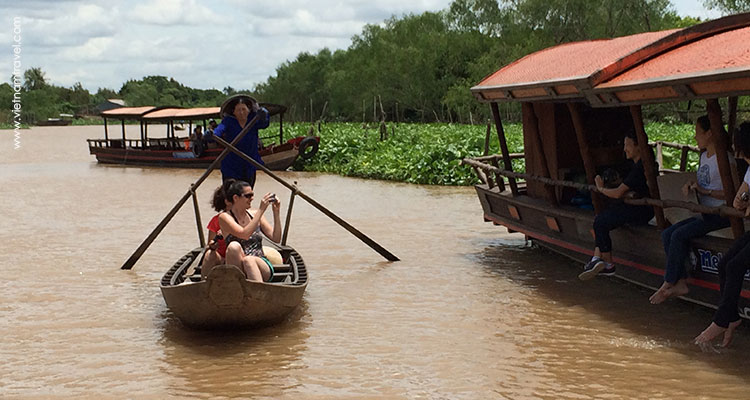
Mekong – the longest river in South East Asia.
Mekong River is the twelfth largest river in the world and the seventh largest river in Asia. The water starts its flow near Tibet in China and runs through China’s Yunnan Province, Myanmar, Laos, Thailand, Cambodia, before finally making its way to Vietnam. The downstream part of the Mekong River flows through the territory of Southern Vietnam and divides into 9 estuaries (now only 7 gates), so it is lovally named as “Song Cuu Long” (translated into English: nine-dragon river).
With a huge amount of sediment deposited every year, the fertile Mekong Delta is the most favorable land for the development of Vietnam’s agriculture. The alluvial flow from this river has made this delta region the largest granary of Vietnam.
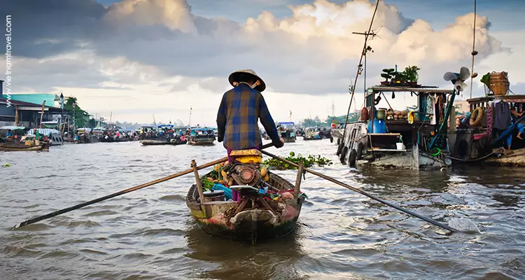
A lady rowing her small boat to Cai Rang Floating Market on the Mekong River (Can Tho City).
Besides the important role in our country’s agriculture, Mekong is also a favorite destination for tourists to learn about the fussy river life. Therefore, nowadays, travel segment in Mekong takes up about 50% of travel volume via the Mekong River Cruises’ system. These Vietnam river cruises offer worldwide travelers the chance to explore Indochina countries with their authentic riverside attractions, non-touristy local villages and many interesting traditional workshops. The unique floating markets where thousands of goods are sold on rustic bamboo boats surely are the first thing both domestic and international tourists think about Mekong Delta. Traveling to Mekong River in Vietnam and witnessing the simple local river life via images of floating markets in Mekong Delta, you have chance to gain more knowledge about the rustic beauty of local people, nature and culture. Tra Su Cajuput Forest in An Giang, U Minh Forest of Ca Mau, Cai Rang Floating Market in Can Tho, are some of experiences you should not miss when planning the trip to Mekong River.
Vietnam Travel offers some carefully designed day trips to Mekong River from Saigon for tourists pressed for time, or those like a glimpse experience only:
– Ben Tre Day Trip From Ho Chi Minh City.
– Cai Be Day Trip From Ho Chi Minh City.
– My Tho Day Trip From Ho Chi Minh City.
Legend of Mekong is our best selling Indochina tour package in 2018. During this 9-day unforgettable journey, travelers could immerse in the sublime beauty of Mekong & its river life. From Saigon’s modern bustle to the calm waters of Tonle Sap Lake and into the ancient Khmer Kingdom; explore South Vietnam and Cambodia on a tour that takes you along the meandering Mekong River all the way to Siem Reap – the home town of Angkor Wat…
In addition to the top 10 rivers we listed above that international tourists often visit, Vietnam also has many other beautiful and famous rivers such as Song Da (the longest river in the North), Bach Dang (famed for its victories that Vietnam defeated Chinese invaders three times by legendary wooden pile traps between 938-1288), Dong Nai River (the longest inland river in Vietnam) etc. We can add any name of rivers in Vietnam for a visit into your itineraries, so just contact our travel consultants for arrangements.
Other interesting things about Vietnam rivers:
– How many rivers in Vietnam? The answer is 2360 rivers (each one is more than 10km long).
– How many cross-border rivers in Vietnam: 23 rivers.
– The total inter-provincial rivers in Vietnam: 392 rivers.
– Vietnam’s longest inland river: Dong Nai River, with a length of 586km.
– The widest river in Vietnam: Hau River (4,000 meters in width, located between Tra Vinh and Soc Trang, a tributary of Mekong River).
– “SÔNG” means “river”. For example: Sông Sài Gòn (Saigon River), Sông Thái Bình (Thai Binh River)…
Vietnam River Map (displays the river paths, rivers network in Vietnam):






 Italiano
 English

